

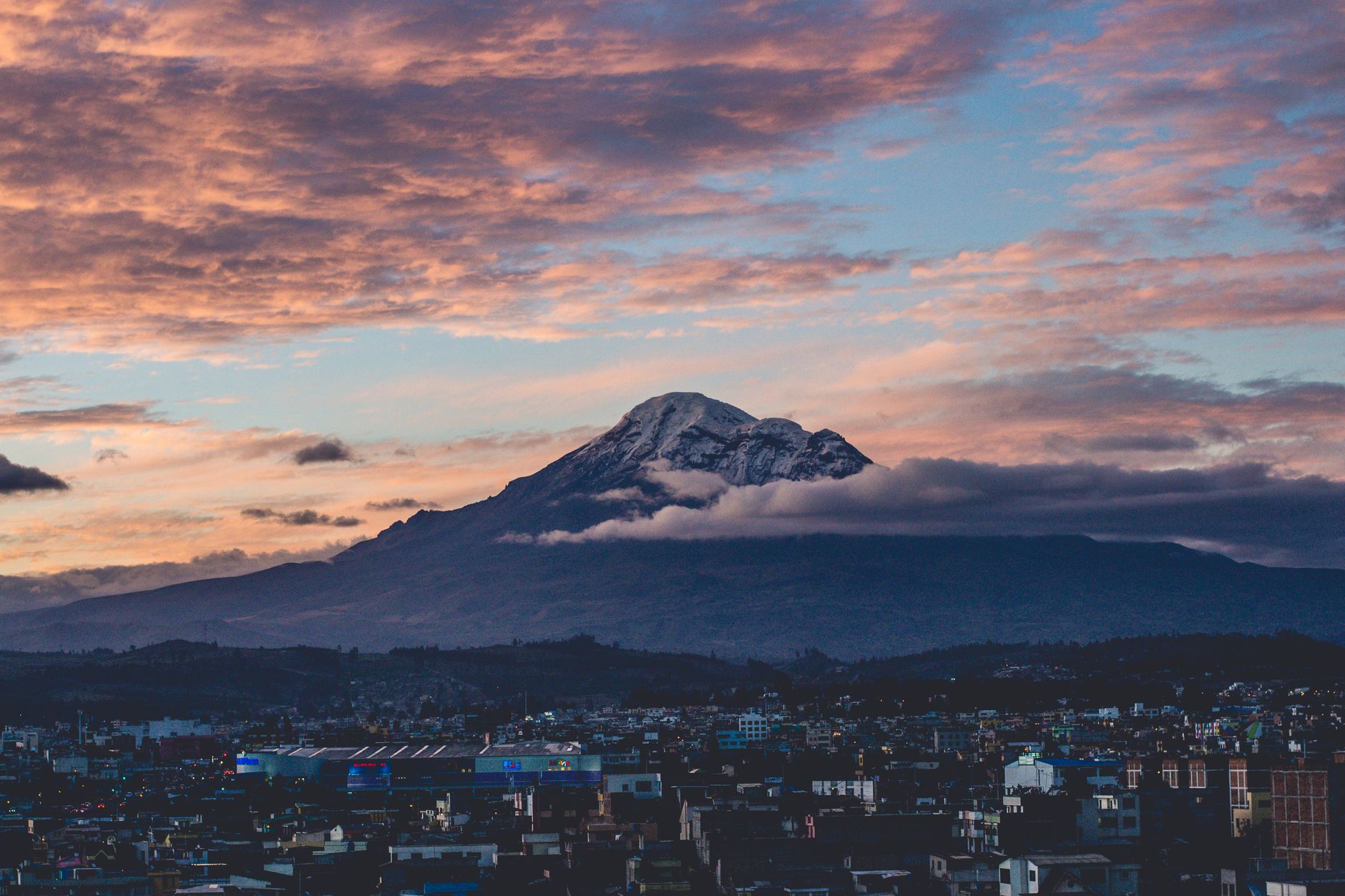
Mount Everest, Mauna Kea and Chimborazo can each be called Earth’s tallest mountain, but only after the measurement is defined. Everest has the highest summit above mean sea level. Mauna Kea rises farther from its nearby seafloor to its summit. Chimborazo’s peak is farther from Earth’s center than any other point on the surface.
These are not competing survey results. They answer three different questions about a planet that is neither a perfect sphere nor a smooth one.
Everest is highest above mean sea level
China and Nepal jointly announced Everest’s official snow-surface elevation as 8,848.86 meters above sea level in 2020. On the definition used by maps, surveyors and mountaineers, Everest remains the world’s highest mountain.
“Above sea level” sounds like a measurement from a visible shoreline. It is more technical than that. Tides rise and fall, winds pile water against coasts, currents shift and gravity varies. Surveyors need a stable reference surface that can be extended beneath continents rather than the water level recorded at one beach on one day.
That reference is related to the geoid, a model of the shape global mean sea level would take under gravity and rotation without the short-term movement of waves and tides. Elevation tells us how far a summit stands above that agreed zero surface. It does not tell us the mountain’s full height from a geological base or the summit’s distance from Earth’s center.
The summit itself also requires a convention. The 8,848.86-meter figure includes Everest’s snow cap. Earlier Chinese results sometimes quoted a lower rock height beneath the snow. Both measurements could be accurate descriptions of different surfaces.
Mauna Kea is mostly hidden underwater
Mauna Kea’s summit on the island of Hawaii is 4,207.3 meters above sea level, according to the US Geological Survey. That number looks modest beside Everest because most of the volcano lies beneath the Pacific.
From the summit, its flanks descend more than four kilometers to the coast and continue underwater for about six kilometers before meeting the deep ocean floor. The agency gives Mauna Kea a total base-to-summit height of nearly 10,211 meters, or about 33,500 feet.
Using those figures, Mauna Kea is roughly 1.36 kilometers taller than Everest from the selected base. A climber starting at sea level would not experience that full rise. The first six kilometers are submerged.
There is a real caveat hidden in the word “base.” Mountains do not have sharp lower boundaries. A broad shield volcano blends into neighboring volcanic material, rests on oceanic crust and bends that crust under its weight. The chosen starting line controls the answer.
The same USGS has described nearby Mauna Loa as standing about 17 kilometers above the deepest part of the down-bowed seafloor beneath it. Under that structural definition, Mauna Loa can claim a larger base-to-summit figure. The familiar Mauna Kea record begins at the adjacent ocean floor, which is the convention used by NOAA’s comparison of the three mountains.
Mauna Kea therefore wins a useful and widely recognized category, not every imaginable version of “from the bottom.”
Chimborazo starts on a wider part of Earth
Chimborazo is a glacier-covered volcano in Ecuador with a summit about 6,268 meters above sea level. It is more than 2.5 kilometers lower than Everest by elevation. Yet its position near the equator gives it an advantage when height is measured from the planet’s center.
Earth’s daily rotation and internal structure make the planet slightly flattened at the poles and wider around the equator. Geodesists describe the simplified shape as an oblate spheroid rather than a sphere. The WGS 84 reference ellipsoid used for mapping and satellite navigation has an equatorial radius of 6,378.137 kilometers and a polar radius of about 6,356.752 kilometers.
The difference is approximately 21.4 kilometers. That is much larger than the elevation gap between Everest and Chimborazo.
Chimborazo sits about one and a half degrees south of the equator, where the underlying reference surface is close to its maximum distance from Earth’s center. Everest stands near 28 degrees north, on a part of the oblate planet that is already several kilometers closer to the center before either mountain’s elevation is added.
NOAA puts Chimborazo’s summit a little more than 2,000 meters farther from the center than Everest’s. The commonly reported geocentric distances are about 6,384.4 kilometers for Chimborazo and 6,382.3 kilometers for Everest. NASA likewise identifies Chimborazo as the surface point farthest from Earth’s center.
Sea level and Earth’s center are different zeros
The Chimborazo result can seem impossible if sea level is imagined as a sphere with a constant radius. It is not. Mean sea level follows Earth’s gravity field, while the distance from the center changes with latitude because the planet is wider at low latitudes.
Consider two runners on different tracks. Elevation above sea level measures how far each runner has climbed above their own starting line. Geocentric distance also accounts for one starting line being farther from the middle of the stadium. Everest gains more elevation, but Chimborazo begins with the larger Earth radius.
Chimborazo is often described as the place closest to the stars or closest to space. Those phrases are loose. The measurable claim is that its summit is farthest from Earth’s center. A difference of about two kilometers is insignificant against stellar distances, and the atmosphere does not use the planet’s center as its zero in the same way.
Everest remains higher above sea level and reaches into thinner air. Chimborazo’s record is geometric.
The measurement should travel with the record
Each winner preserves a different physical idea. Everest is the answer for elevation. Mauna Kea shows how large a volcanic mountain can be when its submerged portion is counted. Chimborazo exposes the effect of Earth’s equatorial bulge.
Other definitions create other records. Topographic prominence measures how independently a summit rises above the lowest saddle connecting it to higher terrain. Vertical rise from a local land base produces another comparison. Geological roots introduce still more judgment about where one structure ends.
“Tallest mountain” is therefore a shorthand, not a complete measurement. The useful part is the reference surface that comes after it.